
Ag Leader Harvest Yield Monitor

Ag Leader’s Yield Monitor is a trusted, accurate system for tracking harvest performance row-by-row and load-by-load. With years of refinement, it continues to be the go-to system for growers who want real, actionable yield data. Key Features On-the-go yield, moisture, and mapping by hybrid or field Works with nearly any combine brand Easy calibration for […]
Ag Leader TurnPath

TurnPath automates headland turns to reduce operator stress and improve consistency. It helps ensure precise entry and exit on every turn, reducing compaction and planting skips. Key Features Automatically calculates and executes headland turns Reduces missed rows or overlapping on curves Ideal for planting, tillage, and spraying operations Minimizes fatigue during long planting windows Compatible […]
Ag Leader RightPath
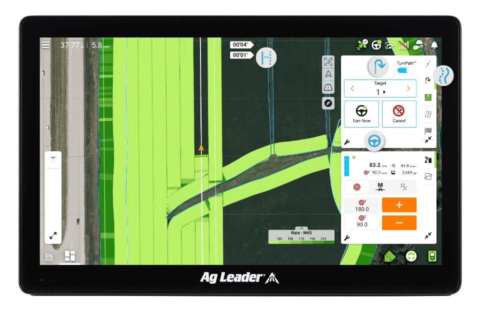
RightPath uses terrain and guidance data to automatically correct implement drift, ensuring your rows stay straight and true — especially on slopes or uneven terrain. Key Features Monitors and adjusts heading drift across varying field contours Reduces crop damage and misalignment in strip-till or planting Works pass-to-pass for guidance refinement Improves efficiency and appearance of […]
Ag Leader DisplayCast Connectivity

DisplayCast allows multiple Ag Leader displays to communicate wirelessly in real time. It ensures data consistency across machines and helps operators stay aligned during planting, application, or harvest. Key Features Syncs coverage maps, guidance lines, and planting data between machines Live performance sharing improves decision-making and efficiency Ideal for multi-machine or multi-operator operations Eliminates redundant […]
Ag Leader AgFiniti Connectivity

AgFiniti is Ag Leader’s cloud-based data management platform, allowing real-time syncing between displays, devices, and trusted advisors. It brings your precision ag data to life with maps, reports, and decision-making tools — anytime, anywhere. Key Features Real-time syncing of planting, application, and harvest data View maps and stats on any web-connected device Share data securely […]
Ag Leader WAAS

WAAS (Wide Area Augmentation System) is a free correction service ideal for growers looking for basic guidance and mapping. It’s a reliable starting point for entry-level precision ag needs. Key Features Free, government-provided signal Typically 6–8″ pass-to-pass accuracy Sufficient for tillage, broadacre spraying, and yield mapping No subscription required Compatible with all Ag Leader GPS […]